Strausberg
Från Rilpedia
| Strausberg | |
|---|---|
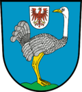
| Vapen | Karta |
 |
.gif) |
| Basfakta | |
| Förbundsland: | Brandenburg |
| Kreis: | Märkisch-Oderland |
| Yta: | 67,86 km² |
| Folkmängd: | 26 153 (31-5-2007) |
| Befolkningstäthet: | 391 invånare/km² |
| Geografiskt läge: | 52° 35' N 13° 54' Ö |
| Postnummer: | 15344 |
| Riktnummer: | (+49) 3341 |
| Registreringsskylt: | MOL |
| Webbplats: | www.stadt-strausberg.de |
| E-postadress: | |
| Politik | |
| Borgmästare: | Hans Peter Thierfeld (partilös) |
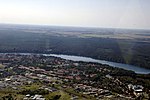
Strausberg är en stad som ligger öster om Berlin.
Innehåll |
Geografi
Orten är känd som före detta säte för Östtysklands arméledning.
Historia
Demografi
<timeline> ImageSize = width:450 height:220 PlotArea = left:70 right:40 top:20 bottom:20 TimeAxis = orientation:vertical AlignBars = justify Colors =
id:gray1 value:gray(0.9)
DateFormat = yyyy Period = from:0 till:30000 ScaleMajor = unit:year increment:5000 start:0 gridcolor:gray1 PlotData =
 bar:1998 color:gray1 width:1
  from:0 till:26445 width:15 text:26445 textcolor:red  fontsize:8px
 bar:1999 color:gray1 width:1
  from:0 till:26370 width:15 text:26370 textcolor:red  fontsize:8px
 bar:2000 color:gray1 width:1
  from:0 till:26221 width:15 text:26221 textcolor:red  fontsize:8px
 bar:2001 color:gray1 width:1
  from:0 till:26512 width:15 text:26512 textcolor:red  fontsize:8px
 bar:2002 color:gray1 width:1
  from:0 till:26629 width:15 text:26629 textcolor:red  fontsize:8px
 bar:2003 color:gray1 width:1
  from:0 till:26644 width:15 text:26644 textcolor:red  fontsize:8px
 bar:2004 color:gray1 width:1
  from:0 till:26593 width:15  text:26593 textcolor:red  fontsize:8px
 bar:2005 color:gray1 width:1
  from:0 till:26533 width:15  text:26533 textcolor:red  fontsize:8px
 bar:2006 color:gray1 width:1
  from:0 till:26238 width:15  text:26238 textcolor:red  fontsize:8px
</timeline>
Turism
Vänorter
- Mall:Landsdata Polen Dębno - Polen (1978)
- Mall:Landsdata Tyskland Frankenthal - Tyskland (1990)
- Mall:Landsdata Tjeckien Terezín - Tjeckien (1998)


