Fil:White Sea Canal map.png
Från Rilpedia
Storlek på förhandsvisningen: 699 × 600 pixel
Högupplöst version (1 000 × 858 pixel, filstorlek: 351 kbyte, MIME-typ: image/png)
Filhistorik
Klicka på ett datum/klockslag för att se filen som den såg ut då.
| Datum/Tid | Miniatyrbild | Dimensioner | Användare | Kommentar | |
|---|---|---|---|---|---|
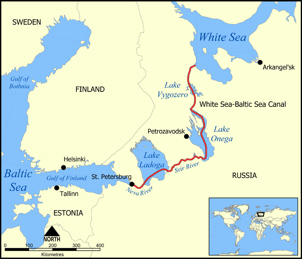
| nuvarande | 6 december 2005 kl. 17.59 | | 1 000×858 (351 kbyte) | NormanEinstein | (This map shows the route of the White Sea-Baltic Sea Canal between the White Sea and Baltic Sea. (Heh heh.) It shows the lakes Vygozero, Onega, and Ladoga, and the Sivr and Neva rivers too. Created by NormanEinstein, December 6, 2005. {{GFDL-self}} [[C) |
Fillänkar
Följande sida länkar till den här filen: