Fil:Map OC-Oceania.PNG
Från Rilpedia
Det finns ingen version med högre upplösning.
Map_OC-Oceania.PNG (500 × 500 pixel, filstorlek: 16 kbyte, MIME-typ: image/png)
Filhistorik
Klicka på ett datum/klockslag för att se filen som den såg ut då.
| Datum/Tid | Miniatyrbild | Dimensioner | Användare | Kommentar | |
|---|---|---|---|---|---|
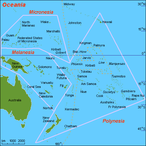
| nuvarande | 28 september 2007 kl. 18.18 | | 500×500 (16 kbyte) | Hobe | ({{Information |Description=map of regions of Oceania |Source=self-made, composed from various mapreferences |Date=2007-09-19 |Author= Hobe Category:Maps of Oceania }} ) |
Fillänkar
Följande 2 sidor länkar till den här filen: