Fil:Map of Hawaii NA.png
Från Rilpedia
Storlek på förhandsvisningen: 776 × 600 pixel
Högupplöst version (2 122 × 1 640 pixel, filstorlek: 370 kbyte, MIME-typ: image/png)
Filhistorik
Klicka på ett datum/klockslag för att se filen som den såg ut då.
| Datum/Tid | Miniatyrbild | Dimensioner | Användare | Kommentar | |
|---|---|---|---|---|---|
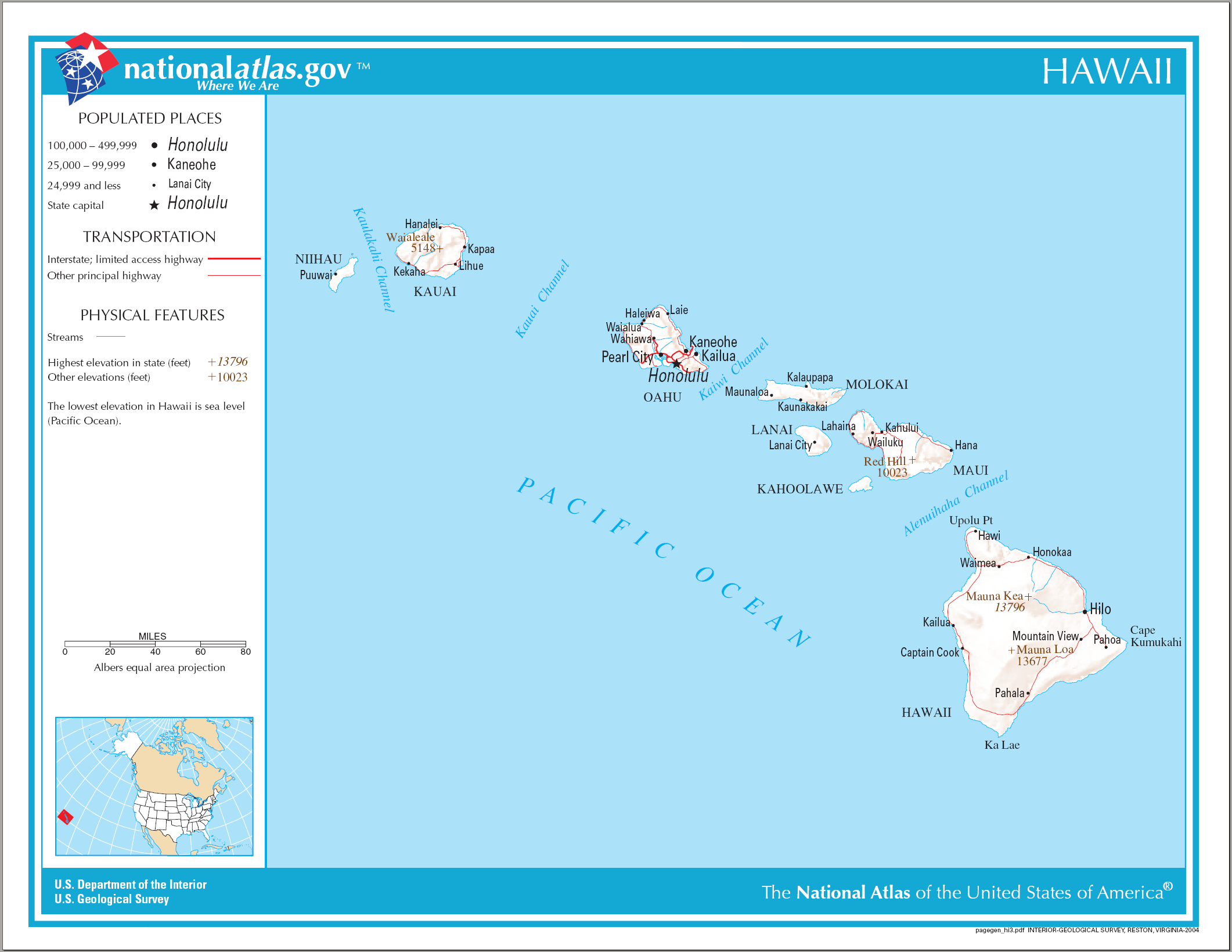
| nuvarande | 15 augusti 2006 kl. 10.26 | | 2 122×1 640 (370 kbyte) | Huebi~commonswiki | ({{Information| |Description=Map of Hawaii |Source=[http://www.nationalatlas.gov National Atlas] }} Category:Maps of the United States Category:Maps of Hawaii {{PD-USGov-Atlas}} ) |
Fillänkar
Följande sida länkar till den här filen: