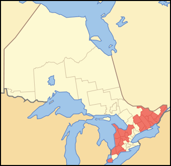
Fil:Map of Ontario COUNTIES.svg
Från Rilpedia
Map_of_Ontario_COUNTIES.svg (SVG-fil, grundstorlek: 340 × 330 pixel, filstorlek: 84 kbyte)
Filhistorik
Klicka på ett datum/klockslag för att se filen som den såg ut då.
| Datum/Tid | Miniatyrbild | Dimensioner | Användare | Kommentar | |
|---|---|---|---|---|---|
| nuvarande | 12 oktober 2007 kl. 11.24 |  | 340×330 (84 kbyte) | Vidioman | ({{Created with Inkscape}} {{Information |Description=A map showing which census divisions of Ontario are counties |Source=Crop and trace of Image:Canada (geolocalisation).svg; trace of [http://en.wikipedia.org/wiki/Image:Ontario_subdivisions.PNG Imag) |
Fillänkar
Följande sida länkar till den här filen: