Fil:Limpopo watershed topo.png
Från Rilpedia
Storlek på förhandsvisningen: 800 × 570 pixel
Högupplöst version (1 150 × 820 pixel, filstorlek: 591 kbyte, MIME-typ: image/png)
Filhistorik
Klicka på ett datum/klockslag för att se filen som den såg ut då.
| Datum/Tid | Miniatyrbild | Dimensioner | Användare | Kommentar | |
|---|---|---|---|---|---|
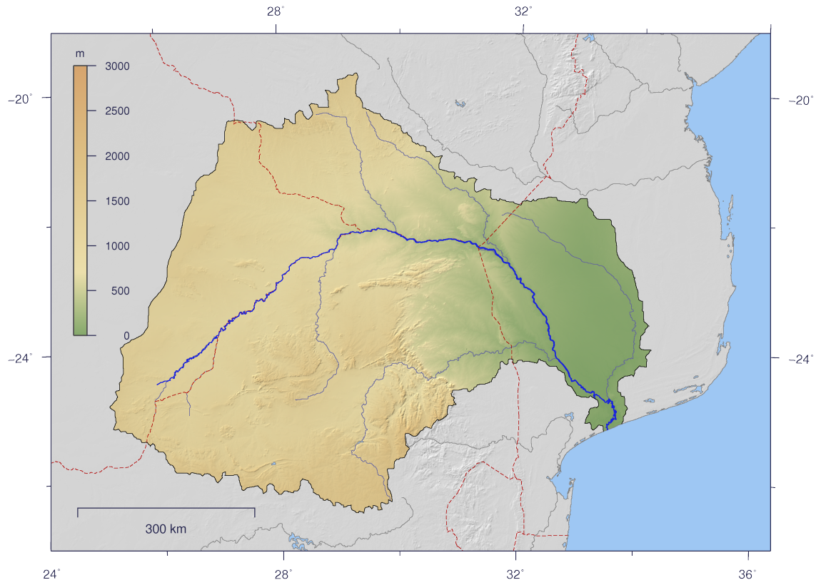
| nuvarande | 25 februari 2007 kl. 15.10 | | 1 150×820 (591 kbyte) | Imagico | ({{Information |Description= {{en|Course and Watershed of the Limpopo River with topography shading and political boundaries.}} {{de|Verlauf und Einzugsgebiet des Limpopo mit Reliefschattierung und Staatsgrenzen.}} |Source=The map has been created with the) |
Fillänkar
Följande sida länkar till den här filen: